

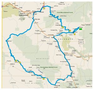
The following are suggested Routes for the Top O' the Rockies Rally
- All rides are self-guided. You are on your own. We recommend that you always go with a partner.
- Any descriptions with Dual Sport mean there are dirt roads on the route.
- All other routes are pavement.
- Conditions on trails change from year to year so be careful.
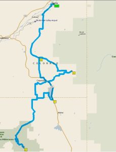
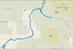
Aspen-Independence-Cottonwood-Crested Butte-Kebler - Dual Sport - 265 miles
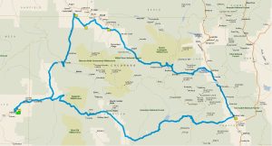 Take 133 through Carbondale down 82 through Aspen over Independence Pass to Hwy 24. You’ll go South to Buena Vista and West on CR 306 over Cottonwood Pass past the Taylor Park Reservoir where it heads NW to Crested Butte, over Kebler Pass, and back to Paonia.
Download PDF Map & Turn-by-Turn
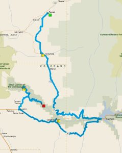
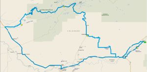
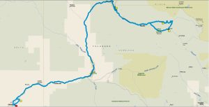
Independence Pass - Cottonwood Pass - Paved Roads - 300 miles
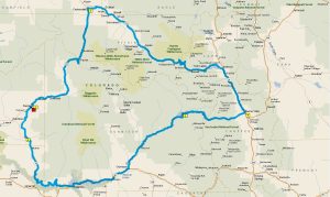 There is some dirt but you can take a motorhome through it. Take you up 133 through Carbondale down 82 through Aspen over Independence Pass to Hwy 24. You’ll go South to Buena Vista and West on CR 306 over Cottonwood Pass past the Taylor Park Reservoir and South to 135 into Gunnison. From there you’ll take 50 West past the Blue Mesa Reservior where you’ll join 92 and head up to Crawford and back to Paonia
Download PDF Map & Turn-by-Turn
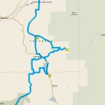
North Rim, Needle Rock Dual Sport - 72 miles
 This short hop offers a shortcut to Crawford and a trip to the North Rim that few know of. The route takes you to Needle Rock and Cottonwood Creek Road for a few curves.
Download PDF Map & Turn-by-Turn
Black Canyon National Monument Paved Route - 224 miles
 This route offers a shortcut to Crawford. At 074.4 Don’t miss the locomotive on the original trestle and the Morrow Point Dam inside this awesome
canyon. 105.1 Interesting and twisty road leading to the East Portal. It is very steep but paved. Use your gearbox!
Download PDF Map & Turn-by-Turn
Divide Road, Lands End Dual Sport - 211 miles
 Following the directions, this route offers a curvy section east of Cedaredge. It’s easy to get lost though!
Download PDF Map & Turn-by-Turn
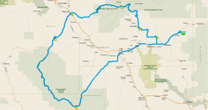
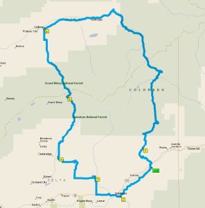
Colorado National Monument, Grand Mesa Paved Route – 198 miles
 This route offers an alternative to 133 leaving Paonia and a great curvy section east of Cedaredge if you follow the directions. It’s easy to get lost though!
Very twisty roads in the Colorado Natl. Monument and fast sweepers on the Grand Mesa CO-65.
Download PDF Map & Turn-by-Turn
Grand Mesa. Lands End - 139 miles
 Lands End Road was built by the CCC between 1933 and 1934. Don’t miss the observatory at the top at 10,500 ft. This route offers an alternative to 133 leaving Paonia and a curvy diversion just off Kannah Road as well as a curvy section east of Cedaredge if you follow directions. It’s easy to get lost though!
Download PDF Map & Turn-by-Turn
Grand Mesa-Buzzard Divide Dual Sport – 115 miles
 This route offers an alternative to 133 leaving Paonia and a nice curvy section west of Hotchkiss if you follow directions. It’s easy to get lost, though! Buzzard Divide and Stevens Gulch Road have some of the largest Aspen trees in Colorado as well as a good wildflower bloom. Stevens Gulch Rd. is ten miles shorter than taking CR-265 to 133 and has a nice steep curvy section on the south end but not near the excellent chicanery on 133 by Paonia Reservoir.
000.3
Download PDF Map & Turn-by-Turn
Kebler Pass, Paradise Divide, Schofield Pass, Ohio Pass, Dual Sport – 161 miles
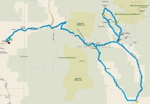 Try Black Bridge Road leaving Paonia. This route gets a little more difficult on Paradise Divide and Schofield Pass but it’s beautiful! There is lots of history and scenery on this route.
Download PDF Map & Turn-by-Turn
Kebler Pass, Ohio Pass, Dual Sport – 153 miles
 Try the Black Bridge Road leaving Paonia for an alternative. This route has a lot of history along its length and a side trip to Needle Rock and a few curves east of Crawford.
Downlaod PDF Map & Turn-by-Turn
Paonia, Marble, Redstone, Paved Route - 108 miles
 Try Black Bridge Road leaving Paonia. This route takes you over McClure Pass to Marble where stone for many Washington monuments was quarried including the Tomb of the Unknown Soldier. The Crystal River Valley is stunning and the ruins of the marble factory are fascinating. The Redstone Inn or a tour of the Redstone Castle is an option.
Download PDF Map & Turn-by-Turn
Marble, Lead King Basin Dual Sport – 102 miles
 Take Black Bridge Road from Paonia as an option. This dual-sport route is difficult but offers some of the most spectacular scenery in Colorado including the Crystal Mill and Lead King Basin. The Lead King Basin is a favorite among photographers for its wildflowers and waterfalls and borders the Snowmass Wilderness.
Download PDF Map & Turn-by-Turn
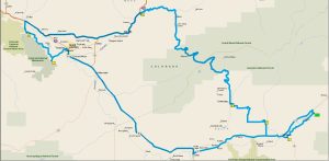
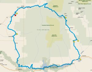
141 and 65 Paved Route – 333 miles
 This route offers an alternative to 133 leaving Paonia and a curvy section east of Cedaredge if you follow the directions. It’s easy to get lost though!